


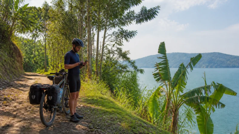

The Congo Nile Trail runs roughly 227 km along Lake Kivu’s hilly western shore, connecting Rubavu in the north to Rusizi in the south, and most people tackle it over several days on foot or by mountain bike — which means connectivity here isn’t a single answer so much as a pattern that repeats: village, signal; ridge or forest stretch, nothing; next village, signal again.
Quick answer: Expect coverage to come and go by the hour rather than stay consistent for a whole day — villages and trailside settlements along the route generally have basic mobile signal, while the ridgelines and remote stretches between them often have none at all. Plan each day’s water, food, and connectivity needs assuming the gaps, not the villages, are the default.
Top Rwanda eSIMs

Rwanda eSIM
Fixed
1 GB, 7 days€ 22.662 GB, 15 days€ 43.993 GB, 30 days€ 61.76Unlimited
Unlimited, 1 day€ 20.88Unlimited, 3 days€ 60.87Unlimited, 5 days€ 100.86
Why coverage is so inconsistent here
The trail follows Lake Kivu’s shoreline through terrain that shifts constantly between small fishing villages, farmland, and steep, sparsely populated hillsides, and mobile towers are naturally concentrated around the populated stretches rather than spread evenly along the route. This is a more extreme version of the pattern covered in the rural mobile coverage guide.
Village stops along the route
Most guided itineraries and independent hikers plan overnight stops in trailside villages, and it’s in these spots — not on the trail between them — where you can reliably expect to check messages, confirm the next day’s plans, or let someone know you’ve arrived safely.
The remote stretches
Between villages, particularly on the trail’s more mountainous middle sections, hikers and cyclists should expect extended periods with no signal at all, sometimes for the better part of a day’s walking or riding. This is a genuine backcountry experience by Rwandan standards, closer to the coverage gaps of deep forest trekking than anything found in the country’s towns.
Guided tours and safety
Tour operators running multi-day trips along the trail typically carry their own communication equipment independent of mobile coverage, similar to how park rangers operate in Rwanda’s national parks, precisely because relying on tourist phone signal for safety along this route isn’t realistic. This matters even more for a solo traveler attempting the trail without a group.
Planning connectivity day by day
Given how unpredictable signal is along the route, downloading offline maps, GPX tracks, and any messages you might need for each day’s leg before setting out is far more reliable than counting on catching a signal mid-route — the Google Maps in Rwanda guide covers setting this up in advance.
Starting or ending points
Both ends of the trail sit in well-connected towns — Rubavu in the north and Rusizi in the south — making them sensible points to handle any connectivity needs before setting out or after finishing, even though the trail itself won’t offer the same consistency.
FAQ
Is there mobile signal along the Congo Nile Trail?
It comes and goes — villages along the route generally have basic coverage, while remote stretches between them often have none.
How long can I go without signal on this trail?
Potentially the better part of a day’s walking or riding on the more remote middle sections.
How do guided tours handle safety without reliable signal?
Operators typically carry their own communication equipment independent of mobile coverage, similar to national park rangers.
Should I download maps before starting the trail?
Yes — offline maps and GPX tracks are far more reliable than expecting to catch signal mid-route.
Are the start and end points of the trail well connected?
Yes — Rubavu and Rusizi both have solid coverage, useful for handling logistics before or after the trek.
Is this the least-connected route in Rwanda?
It’s among the most inconsistent, closer in feel to remote forest trekking than anything in the country’s towns.
Final Recommendation
Plan the Congo Nile Trail assuming disconnection is the default and village signal is the bonus, not the other way around. See the Lake Kivu internet guide for how the trail fits into the wider lake picture.