


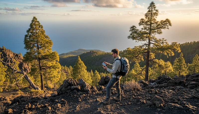

The Canary Islands offer some of Europe’s most varied hiking landscapes. Travellers can explore volcanic trails, pine forests, coastal paths, mountain ridges and remote natural parks across Tenerife, Gran Canaria, La Palma, Lanzarote, Fuerteventura and the smaller islands.
Mobile data is useful for navigation, weather updates, transport information, accommodation messages and emergency communication. However, hikers should never assume that a signal will be available throughout an entire route.
Coverage is usually strongest near towns, roads and popular visitor areas. It may become weak or disappear in deep valleys, volcanic terrain, dense forest, mountain areas and isolated coastal sections.
Quick answer: The best setup for hiking in the Canary Islands is a travel eSIM combined with downloaded offline maps, a fully charged phone and a power bank. Use mobile data for route updates and communication, but prepare to continue safely when no signal is available.
Top Canary Islands eSIMs

Canary Islands eSIM
Fixed
1 GB, 7 days2.00$2 GB, 15 days4.00$3 GB, 30 days5.00$Unlimited
Unlimited, 1 day2.50$Unlimited, 3 days5.50$Unlimited, 5 days9.00$
Europe Extra eSIM
Fixed
1 GB, 7 days2.50$2 GB, 15 days4.00$3 GB, 30 days5.00$Unlimited
Unlimited, 1 day3.00$Unlimited, 3 days6.00$Unlimited, 5 days10.00$Europe+ eSIM
Fixed
1 GB, 7 days3.00$2 GB, 15 days4.50$3 GB, 30 days6.00$Unlimited
Unlimited, 1 day3.00$Unlimited, 3 days7.00$Unlimited, 5 days11.50$Europe Lite eSIM
Fixed
1 GB, 7 days2.50$2 GB, 15 days4.00$3 GB, 30 days5.00$Unlimited
Unlimited, 1 day3.00$Unlimited, 3 days6.00$Unlimited, 5 days10.00$Why Hikers Need Mobile Data in the Canary Islands
A mobile connection can make hiking more convenient and help you respond to changing conditions. It is especially useful when travelling independently or moving between several islands.
Mobile data can help with:
- Opening digital trail maps.
- Checking weather conditions.
- Reviewing route changes or closures.
- Finding public transport connections.
- Calling accommodation or taxi providers.
- Sharing your location with other travellers.
- Checking sunrise and sunset times.
- Finding nearby food, water and services.
- Accessing emergency information where coverage exists.
It should be treated as a useful tool rather than the only part of your hiking safety plan.
Best Internet Options for Hikers
| Internet Option | Best Use | Main Advantage | Possible Limitation |
|---|---|---|---|
| Travel eSIM | Maps, weather and communication | Mobile data without replacing the main SIM | Depends on local coverage |
| Accommodation WiFi | Downloading maps and route information | Good for preparation before departure | Unavailable on the trail |
| Offline maps | Navigation without signal | Works when mobile coverage disappears | Must be downloaded in advance |
| Local SIM card | Longer hiking stays | May include local services | Usually purchased after arrival |
| Public WiFi | Basic use in towns | Often free | Rarely available on hiking routes |
Why an eSIM Is Useful for Hiking
A travel eSIM allows you to access mobile data while keeping your primary SIM card installed. This is useful for hikers who want to preserve their usual number for calls, SMS verification and messaging apps.
An eSIM can help when:
- You need directions to a trailhead.
- You change hiking plans during the day.
- You need to check a bus timetable.
- You move between several islands.
- You need to contact your accommodation.
- You want to share your live location.
- You need data immediately after landing.
Installing the eSIM before departure also avoids the need to search for a local mobile shop after arrival.
Mobile Coverage on Canary Islands Hiking Trails
Mobile coverage varies significantly depending on terrain. A trail close to a town may have a strong connection, while a route behind a mountain ridge may have no signal at all.
| Location Type | Expected Coverage |
|---|---|
| Towns and tourist centres | Usually strong |
| Main roads and trail access points | Often available |
| Popular viewpoints | Variable |
| Deep valleys and ravines | May be weak or unavailable |
| Mountain ridges | Can change quickly |
| Dense forest areas | Potentially inconsistent |
| Remote volcanic terrain | May be unavailable |
| Isolated coastal paths | Variable |
Do not judge an entire hiking route based only on the signal available at the starting point.
Mobile Data for Hiking in Tenerife
Tenerife offers volcanic routes, pine forests, coastal paths and high-altitude hiking. Popular areas include Mount Teide National Park, the Anaga Rural Park and routes around the Teno Mountains.
Mobile coverage is generally reliable near towns, main roads and busy visitor areas. It may become weaker in mountain valleys, remote sections of Anaga, areas behind ridges and parts of Teide National Park.
Before hiking in Tenerife:
- Download the full route offline.
- Check altitude and weather conditions.
- Save the trailhead location.
- Confirm any permit requirements.
- Download transport information.
- Carry warm layers for high-altitude routes.
Conditions near Mount Teide can differ significantly from those at the coast, so check the mountain forecast rather than relying only on resort weather.
Mobile Data for Hiking in Gran Canaria
Gran Canaria has mountain villages, ravines, pine forests and interior hiking routes. Popular areas include routes near Roque Nublo, Tejeda and the central highlands.
Coverage can be reliable around towns and main roads but may become less consistent inside deep valleys and remote inland terrain.
Mobile data is useful for checking bus routes, opening maps and contacting accommodation, but offline navigation is important for mountain hikes.
Mobile Data for Hiking in La Palma
La Palma is one of the most popular Canary Islands for serious hiking. It offers volcanic routes, forest trails, ridges and demanding terrain.
Remote routes may pass through areas with limited signal. Weather conditions can also change rapidly at higher elevations.
Hikers should prepare by:
- Downloading detailed offline maps.
- Saving emergency information.
- Checking official trail notices.
- Carrying sufficient water and food.
- Sharing the planned route with another person.
- Starting with a fully charged phone.
Mobile data should support your planning, but it should not replace proper equipment and route preparation.
Mobile Data for Hiking in Lanzarote
Lanzarote offers volcanic scenery, open terrain and coastal routes. The landscape can make trails appear simple, but heat, wind and limited shade may increase difficulty.
Coverage is generally better near populated areas and main roads. It can become less predictable in isolated volcanic zones and remote coastal sections.
Download maps and route details before leaving your accommodation, particularly when visiting areas far from towns.
Mobile Data for Hiking in Fuerteventura
Fuerteventura has open landscapes, long coastal routes and dry inland terrain. Some walks pass through areas with little shade, few services and limited public transport.
Mobile data is useful for navigation and transport planning, but hikers should carry enough water and avoid depending entirely on phone signal.
Before starting a remote route:
- Check the temperature and wind.
- Save the return route offline.
- Confirm the final bus or transport option.
- Carry more water than expected.
- Protect the phone from heat and dust.
How Much Mobile Data Do Hikers Need?
Maps, weather checks and messaging generally use relatively little data. Photo uploads, video calls and social media can increase consumption quickly.
| Hiking Trip Length | Suggested Data | Typical Use |
|---|---|---|
| Weekend hiking trip | 1GB–3GB | Maps, weather and messages |
| One-week trip | 3GB–5GB | Daily navigation and travel planning |
| Two-week hiking holiday | 5GB–10GB | Maps, browsing and regular communication |
| One-month hiking stay | 10GB–20GB | Daily mobile use and island travel |
| Hiking and remote work | 20GB or more | Work apps, hotspot and video meetings |
Use accommodation WiFi for downloading offline maps, uploading videos and installing application updates.
Offline Maps Are Essential
Offline maps allow your phone to continue displaying saved routes even when no mobile signal is available. They are one of the most important tools for hiking in remote areas.
Before leaving accommodation:
- Download the map for the full route.
- Save the trailhead and finishing point.
- Save transport stops and parking locations.
- Check that the route opens in airplane mode.
- Save an alternative return route.
- Take screenshots of essential information.
Test the downloaded map before the hike rather than assuming it will work automatically.
Can One eSIM Work Across Several Canary Islands?
Yes. A compatible Canary Islands or Spain eSIM can generally work across the islands included in its coverage.
This is useful for hiking itineraries such as:
- Tenerife and Gran Canaria.
- La Palma and Tenerife.
- Lanzarote and Fuerteventura.
- A multi-island hiking holiday.
The original plan validity and data allowance continue while you move between islands.
Using Mobile Data for Weather Updates
Weather conditions can change quickly in mountain areas. Coastal forecasts may not accurately represent conditions on elevated routes.
Check:
- Temperature at the trail altitude.
- Wind speed and gusts.
- Rain probability.
- Visibility.
- Official warnings.
- Sunrise and sunset times.
- Potential trail closures.
Do not continue a route only because your phone still shows a signal. Follow local warnings and turn back when conditions become unsafe.
Battery Management While Hiking
Navigation, GPS, photography and weak signal can drain a phone battery quickly. In low-coverage areas, the device may use additional power while searching for a network.
To preserve battery:
- Start with a fully charged phone.
- Carry a power bank and cable.
- Reduce screen brightness.
- Close unnecessary applications.
- Download maps before departure.
- Use battery-saving mode.
- Turn off Bluetooth when unnecessary.
- Use airplane mode in areas with no signal.
- Keep the phone warm in cold mountain conditions.
Can You Use an eSIM Hotspot While Hiking?
Many phones allow an eSIM connection to be shared through Personal Hotspot or tethering. This is usually unnecessary during a normal hike but may be useful at a trailhead, campsite or accommodation without reliable WiFi.
Hotspot use can consume battery and data quickly. Confirm that tethering is supported by the selected plan before relying on it.
Hiking Safety and Mobile Signal
Mobile data can support hiking safety, but it cannot guarantee rescue communication in every location.
- Tell someone your route and expected return time.
- Do not hike beyond your experience level.
- Carry enough water, food and suitable clothing.
- Follow official trail signs and closures.
- Download maps and emergency details.
- Do not depend on live navigation alone.
- Turn back before weather or daylight becomes a problem.
- Travel with another person on remote routes when possible.
A phone with an active eSIM is helpful, but proper planning remains essential.
How to Install a Canary Islands Travel eSIM
Install the eSIM before departure while connected to stable WiFi.
- Confirm that your phone supports eSIM.
- Choose a suitable Canary Islands data plan.
- Open the QR code or installation instructions.
- Go to your phone mobile network settings.
- Select the option to add an eSIM.
- Scan the QR code.
- Label the line as NoveSIM or Travel.
- Keep the eSIM installed until arrival.
After landing, select the travel eSIM for mobile data and enable Data Roaming on that line.
Recommended eSIM Settings for Hiking
| Setting | Recommended Configuration |
|---|---|
| Travel eSIM | Enabled |
| Mobile Data | Select the travel eSIM |
| Data Roaming | Enabled on the travel eSIM |
| Main SIM roaming | Disabled unless intentionally used |
| Automatic Data Switching | Disabled |
| APN | data.esim |
Can You Keep Your Main SIM Active?
Yes. Most dual-SIM phones allow you to keep your primary SIM active while the travel eSIM provides mobile data.
This may allow you to:
- Keep your usual phone number.
- Receive SMS verification codes.
- Continue using WhatsApp with the same account.
- Use the eSIM for maps and weather information.
- Avoid removing your physical SIM card.
Your home operator may charge for calls, SMS or roaming services. Disable mobile data roaming on the main SIM unless you intentionally want to use it.
What to Do If the eSIM Does Not Connect
- Confirm that the eSIM is enabled.
- Select it as the preferred Mobile Data line.
- Enable Data Roaming on the eSIM.
- Disable Automatic Data Switching.
- Check that the APN is set to data.esim.
- Activate Airplane Mode for approximately 30 seconds.
- Turn Airplane Mode off and wait for the network.
- Restart the phone.
- Move toward a town, main road or open area.
Do not delete the eSIM while troubleshooting unless support specifically advises you to do so. Some QR codes can only be installed once.
How to Reduce Data Usage While Hiking
- Download maps through WiFi.
- Take screenshots of route information.
- Disable automatic photo uploads.
- Pause app and system updates.
- Download music before leaving.
- Turn off background data for unnecessary apps.
- Avoid uploading long videos on the trail.
- Monitor mobile usage in phone settings.
Canary Islands Hiking Connectivity Checklist
- Confirm that your phone supports eSIM.
- Install the eSIM before departure.
- Download the complete route offline.
- Check weather and trail warnings.
- Save transport and accommodation details.
- Charge your phone fully.
- Carry a power bank and cable.
- Tell someone your hiking plan.
- Carry water, food and suitable clothing.
- Do not rely entirely on mobile coverage.
Related Articles
- Best eSIM for Canary Islands
- Canary Islands Travel Internet Guide
- Mobile Data for Island Hopping Canary Islands
- Internet for Canary Islands Road Trip
- Internet for Surfing in Canary Islands
FAQ
Will mobile data work on hiking trails in the Canary Islands?
Coverage is often available near towns, roads and popular areas, but it may disappear in valleys, mountain terrain, forests and remote coastal sections.
Do I need an eSIM for hiking in the Canary Islands?
An eSIM is useful for maps, weather, transport and communication, but you should also download offline maps and prepare for areas without signal.
How much data do I need for a one-week hiking trip?
Approximately 3GB–5GB may be enough for maps, weather checks, messages and regular browsing when accommodation WiFi is available.
Can one eSIM work on several Canary Islands?
Yes. A compatible Canary Islands or Spain eSIM can generally work across the islands included in the plan coverage.
Should I download offline maps?
Yes. Offline maps are essential because mobile coverage can become weak or unavailable on remote hiking routes.
Can I call for help without mobile data?
Voice service may sometimes be available even when data is weak, but no mobile connection is guaranteed in remote terrain. Follow local safety guidance and share your route in advance.
Will WhatsApp keep my original number?
Yes. WhatsApp normally remains linked to your existing registered number while using mobile data from the travel eSIM.
Should I use my phone as my only navigation tool?
No. Carry downloaded maps, enough battery and an alternative navigation method for demanding or remote routes.
Final Recommendation
The best mobile data setup for hiking in the Canary Islands combines a travel eSIM with offline maps, careful route planning and reliable battery backup. Use the eSIM for weather updates, transport, communication and navigation where coverage is available.
A NoveSIM travel eSIM lets you prepare your mobile connection before departure and stay connected across supported Canary Islands without removing your main SIM card. Install it before your trip, download every hiking route in advance and never depend entirely on mobile signal in remote terrain.