
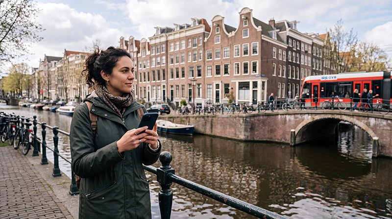

Traveller using Google Maps for navigation during a trip through the Netherlands

Google Maps in the Netherlands: Navigation and Offline Maps Guide

Google Maps is a useful travel tool for visitors exploring the Netherlands. It can help you find hotels, museums, railway stations, restaurants, parking facilities and attractions across Amsterdam and other Dutch destinations.

The app is especially convenient for walking and driving directions. It can also show cycling and public transport routes, although dedicated Dutch transport apps may provide more detailed information for complex train, tram, bus or metro journeys.

Quick answer: download the required Dutch map areas before departure, keep mobile data available for live directions and compare public transport routes with an official Dutch journey-planning app when necessary.

Top Netherlands eSIMs

Can You Use Google Maps in the Netherlands?

Yes. Google Maps can be used throughout the Netherlands for common travel tasks, including:

  • Walking directions.
  • Driving navigation.
  • Cycling route suggestions.
  • Public transport planning.
  • Finding hotels and attractions.
  • Locating restaurants, shops and facilities.
  • Saving places for later.
  • Downloading selected areas for offline use.

The app is useful in major cities such as Amsterdam, Rotterdam, The Hague and Utrecht, as well as during road trips and visits to smaller towns.

What Google Maps Is Best For

Travel Task How Useful Google Maps Is
Walking between attractions Very useful
Driving across the Netherlands Very useful
Finding restaurants and shops Very useful
Basic cycling directions Useful, but check local cycling conditions
Simple public transport journeys Useful
Complex train and local transport connections Compare with a dedicated Dutch transport app

Using Google Maps for Walking

Walking is one of the easiest ways to explore historic Dutch city centres. Google Maps can guide you between hotels, museums, restaurants, railway stations and canal areas.

Before starting a walking route:

  • Confirm the exact destination entrance.
  • Check the estimated walking time.
  • Save the hotel location.
  • Download the surrounding map area.
  • Check the weather forecast.
  • Keep enough phone battery for the return route.

Pay attention to bicycle lanes. Dutch cycling infrastructure is extensive, and visitors should avoid walking or standing in designated bike paths while checking directions.

Using Google Maps for Public Transport

Google Maps can suggest routes combining trains, trams, buses, metros, ferries and walking. It is useful for comparing general travel options and finding the route from a station to your accommodation.

For journeys involving several operators or important transfers, compare the result with a dedicated Netherlands public transport app. Live platform changes, disruptions and operator-specific information may be clearer in a local transport service.

Before boarding:

  • Check the final destination shown on the vehicle.
  • Confirm the departure platform or stop.
  • Save the route or take a screenshot.
  • Download any digital ticket.
  • Allow extra time for transfers.

Using Google Maps on Dutch Trains

Google Maps can help you locate the railway station, plan a basic connection and navigate after arriving in another city. However, it should not be your only source for important train information.

Use a Dutch railway or journey-planning app to confirm current departure times, platform information and disruptions. Save your hotel address and the walking route from the destination station before travelling.

Using Google Maps for Cycling

The Netherlands is a popular cycling destination, and Google Maps may offer bicycle route suggestions. It can be useful for short city journeys and general route planning.

For longer recreational rides, consider combining it with a dedicated cycling app or an official route map. Some Dutch routes use numbered cycling junctions that may not always be the main focus of a general navigation app.

Before cycling:

  • Download the complete route.
  • Check the distance and expected duration.
  • Save the bicycle rental location.
  • Review the weather and wind forecast.
  • Carry a charged power bank.
  • Use a secure phone mount when appropriate.

Stop in a safe place before changing the route. Do not hold or operate the phone while actively cycling.

Using Google Maps for Driving

Google Maps can support road trips between Dutch cities, countryside attractions, beaches and accommodation. Mobile data helps the app update routes when traffic or road conditions change.

Before driving:

  • Download offline maps for the complete journey.
  • Save the rental car return location.
  • Confirm the hotel or parking address.
  • Check whether your destination has restricted access.
  • Identify fuel or charging stops.
  • Set the route before moving.

Do not operate a handheld phone while driving. Use a suitable mount, the vehicle’s navigation display or ask a passenger to manage route changes.

Can Google Maps Help with Parking?

Google Maps can help you find parking garages and navigate to their entrances. It may also display reviews, opening information and basic facility details.

Always confirm current parking conditions through the garage operator or local parking service. Prices, access rules, vehicle-height limits and opening hours may change.

Save the parked vehicle’s location before walking away, especially when using a large garage or unfamiliar city district.

How to Download Offline Maps for the Netherlands

  1. Open Google Maps while connected to reliable WiFi.
  2. Search for the city or region you plan to visit.
  3. Open the offline maps section in your account menu.
  4. Select the required area.
  5. Adjust the map boundaries to cover your route.
  6. Download the map before departure.
  7. Confirm that it is stored on the device.

Download separate areas when your itinerary includes several distant regions. Complete the downloads through hotel or home WiFi to avoid using your travel data allowance.

What Works with an Offline Map?

An offline map can provide essential map access when the phone temporarily loses its mobile connection. It may support basic navigation within the downloaded area, but some live features will be unavailable.

Feature Offline Availability
Viewing downloaded roads and locations Generally available
Basic driving navigation May be available within the downloaded area
Live traffic information Requires internet
Current public transport departures Requires internet
Live route changes Requires internet
New reviews and updated business details Requires internet

Offline maps are a backup rather than a complete replacement for mobile data.

Why Mobile Data Still Matters

An active connection allows Google Maps to update traffic conditions, recalculate routes and retrieve current information about businesses and transport.

Mobile data is particularly useful for:

  • Live traffic updates.
  • Public transport changes.
  • Searching for nearby places.
  • Reviewing current opening information.
  • Finding alternative routes.
  • Sharing a location with a travel companion.
  • Downloading a new map area.

A Netherlands travel eSIM can provide mobile data without requiring you to remove your regular SIM card.

Browse Netherlands eSIM plans.

Recommended eSIM Settings

Setting Recommended Value
Travel eSIM Enabled after arrival
Mobile Data Travel eSIM
Data Roaming on travel eSIM On
Data Roaming on primary SIM Off
Automatic Data Switching Off
Network Selection Automatic
APN data.esim when required

How Much Data Does Google Maps Use?

Map navigation generally uses less data than video streaming, but usage depends on route length, map detail, satellite imagery and how often new areas are loaded.

To reduce data consumption:

  • Download map areas through WiFi.
  • Avoid satellite view when it is not needed.
  • Save frequent destinations.
  • Plan routes before leaving the hotel.
  • Disable unnecessary background app activity.
  • Use WiFi for large map downloads.

NoveSIM unlimited plans include 1 GB of high-speed data per 24-hour period. Speed may be reduced after the daily high-speed allowance is used and restored at the next reset.

How to Save Places Before Your Trip

Create a list of important locations before travelling. This makes daily planning faster and helps prevent mistakes caused by similar business or hotel names.

Useful places to save include:

  • Your accommodation.
  • Airport or railway arrival point.
  • Museums and attractions.
  • Restaurants with reservations.
  • Parking facilities.
  • Bicycle rental shops.
  • Meeting points.
  • Rental car return location.

Share the list with your travel companions when everyone needs access to the same itinerary.

Google Maps Safety Tips

  • Check your surroundings before following a route.
  • Do not walk in bicycle lanes.
  • Do not operate the phone while cycling.
  • Do not adjust navigation while driving.
  • Confirm the destination entrance before arrival.
  • Keep the phone secure in crowded areas.
  • Carry a charging cable or power bank.

A suggested route may not reflect every temporary closure, construction project or local restriction. Follow official signs and instructions when they differ from the app.

What If Google Maps Has No Internet?

  1. Confirm that the travel eSIM is selected for Mobile Data.
  2. Turn on Data Roaming for the travel eSIM.
  3. Keep Data Roaming off on the primary SIM.
  4. Disable Automatic Data Switching.
  5. Keep Network Selection on Automatic.
  6. Check that the APN is data.esim.
  7. Turn Airplane Mode on for 30 seconds and turn it off.
  8. Restart the phone when necessary.

Move outdoors or away from an underground station before changing advanced settings. Mobile signal may be temporarily weaker in tunnels, underground parking areas and enclosed buildings.

Do not delete the eSIM during troubleshooting. The installation QR code may be valid for one installation only.

FAQ

Does Google Maps work in the Netherlands?

Yes. It can be used for walking, driving, cycling, place searches and public transport planning.

Can I use Google Maps offline in the Netherlands?

You can download selected areas for offline use, but live traffic, current public transport information and new searches may require internet access.

Is Google Maps enough for Dutch train travel?

It is useful for general planning, but confirm important train journeys with a dedicated Dutch railway or public transport app.

Can I use Google Maps while cycling?

Yes, but longer routes may benefit from a dedicated cycling app. Stop safely before reading or changing directions.

Do I need mobile data for Google Maps?

Offline maps provide a backup, but mobile data is recommended for live traffic, route changes, transport updates and place searches.

What APN should I use for NoveSIM?

Use data.esim when manual APN configuration is required.

Final Recommendation

Google Maps is a practical navigation tool for walking, driving, cycling and general trip planning in the Netherlands. Download important areas before departure and save your accommodation, attractions and transport locations.

Use dedicated Dutch transport apps to confirm complex public transport journeys and live railway information. Always follow local signs and safety rules when they differ from the suggested route.

Keep mobile data available for traffic updates, new searches and route changes. A Netherlands travel eSIM provides convenient connectivity while allowing your primary SIM to remain in the phone.

Browse Netherlands eSIM plans here.

Scroll to Top