


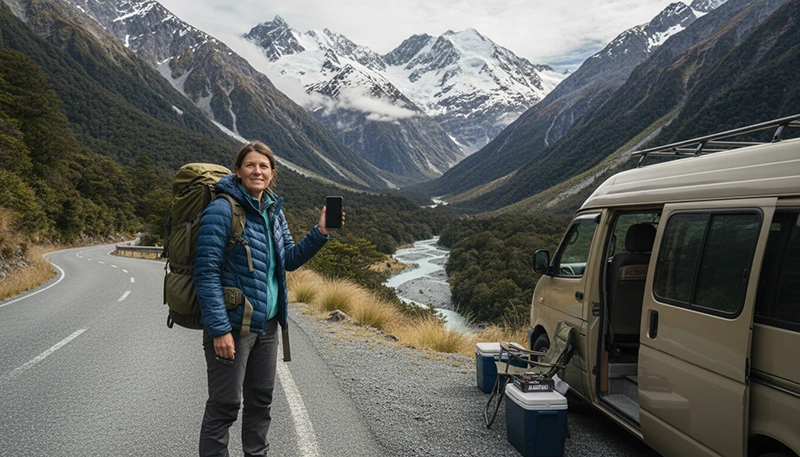

The Great Alpine Highway is one of New Zealand’s most spectacular road trips, connecting Christchurch with the West Coast through the dramatic landscapes of the Southern Alps.
The route passes through Canterbury plains, mountain passes, alpine villages and remote wilderness areas, including the famous Arthur’s Pass National Park.
For international travellers driving this route, mobile internet is extremely useful for navigation, weather updates, accommodation, road conditions and discovering attractions along the way.
Quick answer: Internet coverage on the Great Alpine Highway is generally good in Christchurch and towns, but mountain areas around Arthur’s Pass can have limited or no signal. A New Zealand travel eSIM combined with offline maps is the best setup for this road trip.
Top New Zealand eSIMs

New Zealand eSIM
Fixed
1 GB, 7 days€ 2.182 GB, 15 days€ 3.933 GB, 30 days€ 5.24Unlimited
Unlimited, 1 day€ 2.62Unlimited, 3 days€ 6.54Unlimited, 5 days€ 10.47
Asia eSIM
Fixed
1 GB, 7 days€ 4.362 GB, 15 days€ 7.853 GB, 30 days€ 10.47Unlimited
Unlimited, 1 day€ 5.67Unlimited, 3 days€ 15.27Unlimited, 5 days€ 24.87Why You Need Internet on Great Alpine Highway
The Great Alpine Highway crosses one of New Zealand’s most dramatic landscapes. Although the route is well travelled, large sections pass through remote mountain areas.
Mobile data helps travellers with:
- GPS navigation.
- Checking road conditions.
- Weather forecasts.
- Finding fuel stations.
- Booking accommodation.
- Checking attraction opening times.
- Communicating during the journey.
For campervan travellers, internet access provides extra flexibility when exploring remote areas.
Does Mobile Internet Work on Great Alpine Highway?
Yes, but coverage changes throughout the route.
Travellers can expect strong connectivity in:
- Christchurch.
- Darfield.
- Castle Hill area.
- Arthur’s Pass village.
- Greymouth.
Coverage may become weaker in:
- Mountain passes.
- Deep valleys.
- Arthur’s Pass National Park.
- Remote hiking areas.
| Route Section | Expected Connectivity |
|---|---|
| Christchurch | Excellent |
| Canterbury Plains | Very good |
| Castle Hill / Lake Pearson | Variable |
| Arthur’s Pass | Limited in some areas |
| Otira Gorge | Variable |
| Greymouth | Good |
Mobile Coverage Around Arthur’s Pass
Arthur’s Pass is the most remote section of the Great Alpine Highway and the area where travellers are most likely to experience connectivity gaps.
The landscape includes:
- High mountain ranges.
- Deep valleys.
- Alpine terrain.
- National park wilderness.
Before entering the mountain section, it is recommended to:
- Download offline maps.
- Save accommodation details.
- Check weather forecasts.
- Download important travel information.
Best Mobile Networks for Great Alpine Highway
New Zealand has three main mobile networks used by travellers:
| Network | Best For |
|---|---|
| Spark | Often preferred for regional coverage |
| One NZ | Cities and tourist destinations |
| 2degrees | Populated areas and towns |
On mountain routes like Great Alpine Highway, terrain usually has a bigger impact than the network itself.
Best eSIM for Great Alpine Highway Road Trip
A New Zealand travel eSIM is the easiest option for international visitors travelling between Christchurch and the West Coast.
Benefits include:
- Install before arrival.
- No need to search for a SIM card.
- Keep your home number active.
- Use online navigation when connected.
- Access mobile data across New Zealand.
An eSIM connects through available partner networks but cannot provide service where there is no coverage.
Offline Maps for Great Alpine Highway
Offline maps are strongly recommended for this route because parts of the journey cross remote alpine areas.
Download before leaving Christchurch:
- Christchurch region.
- Canterbury area.
- Arthur’s Pass route.
- West Coast region.
Useful navigation apps:
- Google Maps offline.
- Organic Maps.
- Maps.me.
- Outdoor navigation apps.
Internet Setup for Campervan Travel
The Great Alpine Highway is a popular campervan route. A reliable setup includes:
| Tool | Purpose |
|---|---|
| New Zealand eSIM | Internet where coverage exists |
| Offline maps | Navigation without signal |
| Power bank | Keeps devices charged |
| Downloaded bookings | Backup information |
How Much Data Do You Need?
| Traveller Type | Recommended Data |
|---|---|
| Navigation and messages | 2–3GB |
| Great Alpine Highway trip | 5GB |
| Full South Island adventure | 5–10GB |
| Remote work while travelling | 10GB+ |
What to Do If You Lose Signal
No signal in alpine areas is normal.
If your internet stops working:
- Check your location.
- Use offline maps.
- Save battery power.
- Wait until reaching the next connected area.
- Check eSIM settings after reconnecting.
Recommended eSIM Settings for New Zealand
| Setting | Recommended |
|---|---|
| Mobile Data | New Zealand eSIM |
| Data Roaming | Enabled on eSIM |
| Main SIM roaming | Disabled |
| Network Selection | Automatic |
| APN | data.esim |
Related New Zealand Road Trip Guides
- Internet West Coast New Zealand Road Trip
- Internet Christchurch to Queenstown Road Trip
- Mobile Data Remote New Zealand
- Offline Maps New Zealand Travel
- New Zealand eSIM
FAQ
Is there internet on Great Alpine Highway?
Yes, most towns have good coverage, but mountain sections may have limited or no signal.
Will my eSIM work on Arthur’s Pass?
It works where partner networks provide coverage, but some areas of Arthur’s Pass have limited connectivity.
Do I need offline maps for Great Alpine Highway?
Yes. Offline maps are recommended because the route crosses remote alpine areas.
How much data do I need for this road trip?
Most travellers need 5–10GB depending on the length of their New Zealand trip.
Which network is best for Great Alpine Highway?
Spark is often preferred for regional travel, but coverage depends heavily on terrain.
Final Recommendation
The Great Alpine Highway is one of New Zealand’s most scenic road trips, but it also crosses areas where mobile coverage can change quickly.
The best setup is a New Zealand eSIM for connectivity, offline maps for mountain sections and preparation before leaving Christchurch.
With the right travel setup, you can enjoy the Southern Alps, Arthur’s Pass and the West Coast while staying connected whenever coverage is available.